 |
|
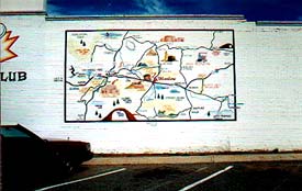
When not smuggling heroin for the CIA, I enjoy taking photos of maps on walls. Mural maps. This fine specimen is on a side street in downtown Winslow, Arizona. Winslow is the kind of town where missing kids are found after a nation-wide manhunt, chopped up into little pieces and packed in an old meat freezer that sits on the back porch of a bungalow that borders the railroad tracks. The kind of town where old folks off the interstate fuel up their million-dollar RV's, only to be set upon by switchblade wielding meth addicts with bad teeth and sweat-stained baseball caps. It's a creepy town with lots of old coffee shops and neon bars and a whole population that's gotten way too much sun. |
 |
|
I passed by this map one morning in Boulder City, Nevada. Boulder City is where all the dam builders lived when they were building the Hoover Dam. Now it's populated by the descendents of dam builders. There are no casinos in B.C., which makes it a kind of oasis, not just from the casinos of Las Vegas, but from the whole American West, which is slowly turning into one giant casino; where even the deer and the antelope play slots. |
 |
|
I couldn't begin to tell you where Glenwood, New Mexico is, and this map doesn't help, either. I couldn't tell if all the names of the towns and the numbers on the highways had faded away, or if the map painter just never got around to painting them on the map. This map reminds me of those schematics you see in the meat department at the grocery store, that divide a cow up into all its cuts - the rump roast, the prime rib - as if your dinner were somehow a part of the cow's anatomy. |
 |
|
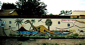
In Holbrook, Arizona, there's a mural map that wraps around an entire parking lot. The map follows a stretch of old Rt. 66 through Arizona, highlighting attractions like the Petrified Woods or the Rainbow Forest Museum with all these splashy paintings of dinosaurs and Indians and Mexican guys in sombreros-- all the stuff that honkies from Delaware dream about when they dream about the West. |
 |
|
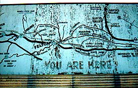
I was looking for some Petrified Wood Roadside Park when I came across this map behind a Sonic, or maybe it was a Dairy Queen, in Felton, California. The map was peeling and the big You Are Here was fading, which made me wonder what'll happen when it disappears altogether-- then where will we be? |
 |
|
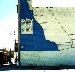
Maybe it was the same trip, or maybe it wasn't. I was heading up the coast to San Luis Obispo, or maybe I'd already been there. I drove through little Guadalupe, California, and I parked my car at the far end of a big gravel parking lots and I crunched over to this map and took a picture. The inset listed the distance of all these towns in California from Guadalupe, as if that was the point of the map: to let you know how far you'd have to go to get the hell away from this place. |